Turn farm visits into lender-ready solar irrigation decisions.
Green-Irrigate Ghana helps extension officers and farmers move from uncertain, rain-fed planning to clear solar irrigation assessments backed by satellite-verified solar resource data, crop water demand modeling, and lender-readable reporting.
Primary user
Agricultural extension officers
Core outcome
Bankability score + PDF report
Field reality
Mobile-first · 3G · Offline
Assessment snapshot
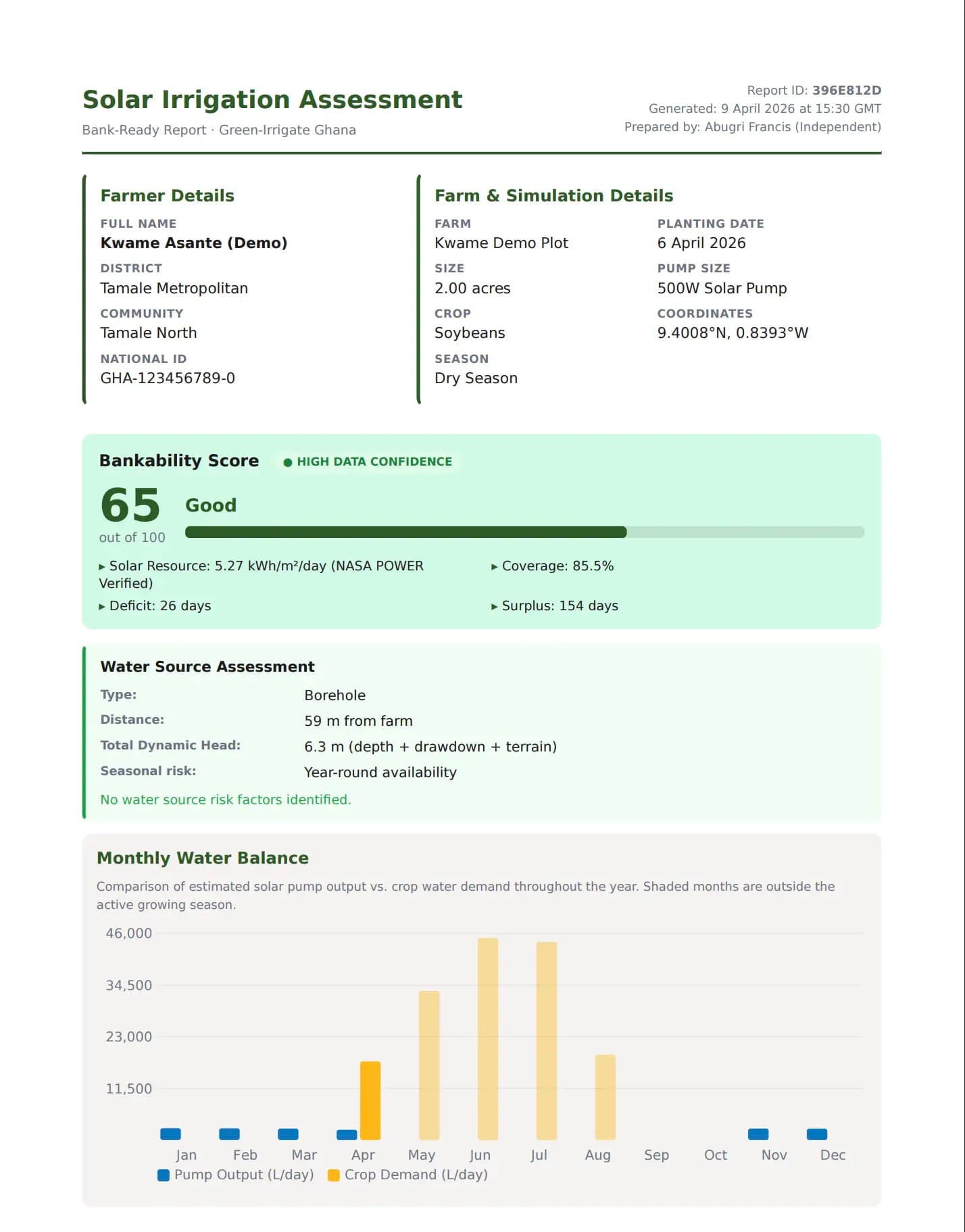
What the officer leaves with: a bankability score, crop-pump match, and a PDF report ready for any MFI or solar vendor.
Why this matters
The problem is not solar potential. It is decision confidence.
Farmers and extension officers already know the dry season opportunity is there. What is usually missing is a credible way to answer three practical questions: can this pump meet the crop's water needs, what does the water source really imply for pump output, and will a lender trust the assessment?
GIG bridges that gap, a field-captured assessment that answers the technical questions lenders ask, delivered as a PDF report extension officers and farmers can take to any MFI or solar vendor.
Workflow
Built around the field reality
Three steps, one field visit, from farm data to a report your lender can read.
01
Capture the farm
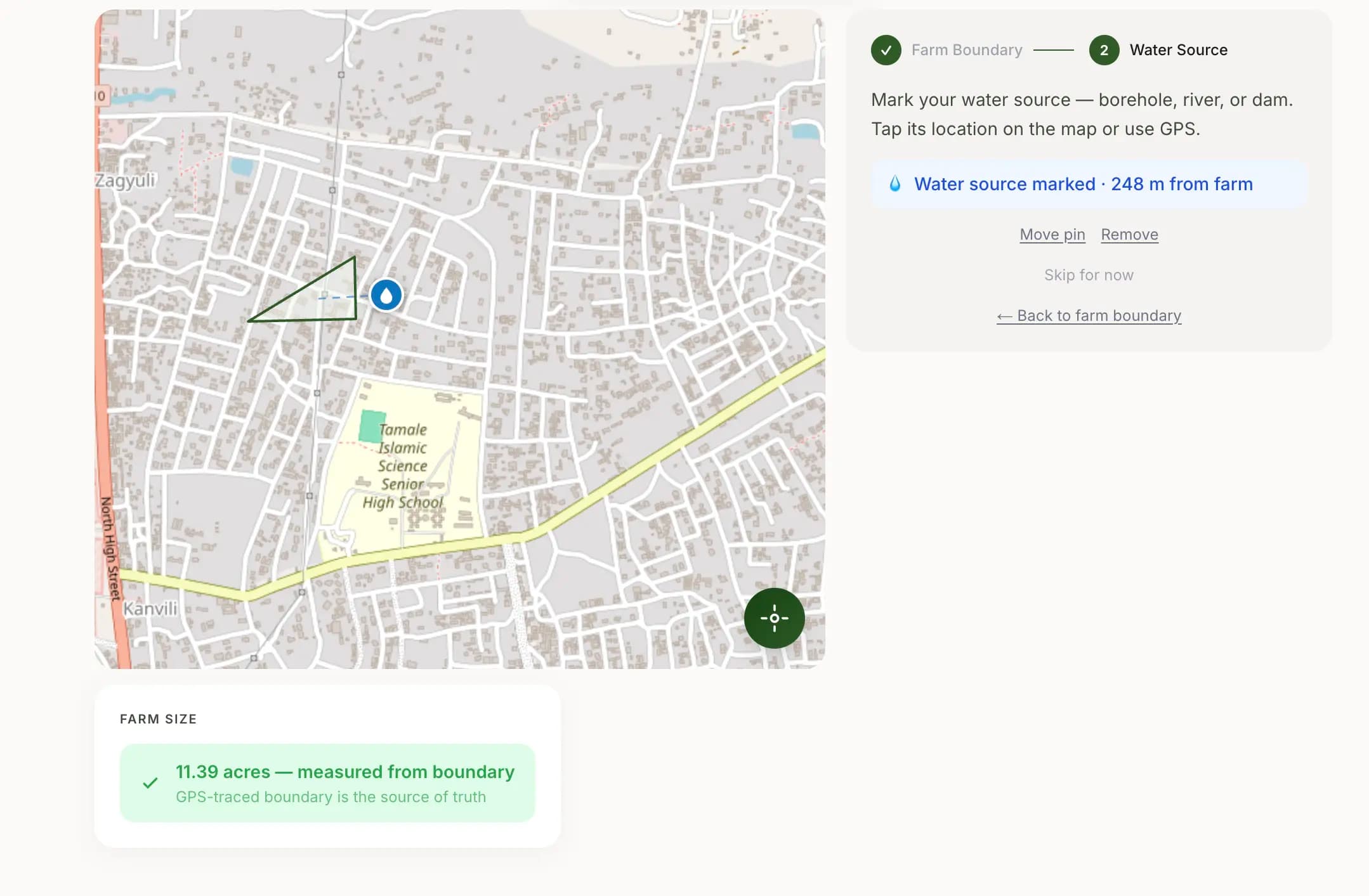
An extension officer records the farm boundary, crop, season, and water source while standing in the field.
02
Run the assessment
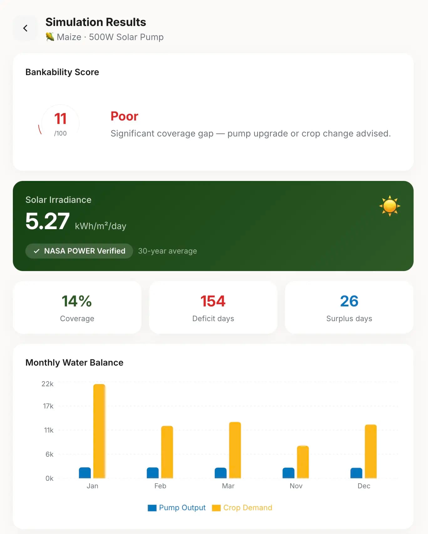
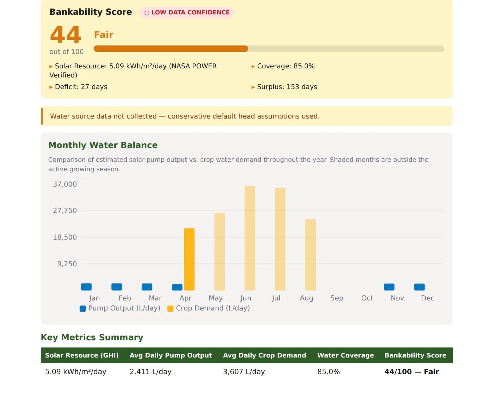
GIG combines NASA POWER solar data, crop water demand, and pump modeling to score how well a solar system can serve that farm.
03
Take a credible report to a lender
The result is a bankability score and PDF report that supports loan conversations with MFIs and solar vendors. No spreadsheet required.
Who this is for
Farmers benefit. Institutions trust. Extension officers move the work.
GIG exists because the gap between a good farm visit and a fundable loan application should not fall on the farmer to close. Extension officers capture the data. The platform does the analysis. The farmer gets a credible document.
Built for extension officers first
Mobile-first screens, high-contrast outdoor layout, offline-aware workflows, and 48 px tap targets, designed for a mid-range Android in the field, not a desktop in an office.
Farmers remain the beneficiary
GIG helps smallholder farmers access better irrigation decisions and stronger financing pathways. The tool is used on their behalf by the extension officer, but the PDF and the outcome belong to the farmer.
Trust is the product
The real advantage is not just the simulation. It is the confidence that comes from transparent methodology, water-source context, and a report lenders can verify independently.
Methodology
Satellite-verified, not just estimated
Every output cites its source. Data confidence is shown explicitly in the PDF report so lenders know what was field-measured, what was derived from satellite data, and what was defaulted, with no unsupported precision claims.
See GIG in action
Start with a conversation, not a login.
Book a quick call with our team. We will walk you through the field workflow, show you a live assessment, and help you decide if GIG fits your operation.